Atlas Boundary .BNA Export Options Dialog
The Export Options dialog allows you to specify options which determine how information in the file is exported.
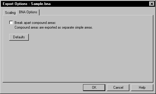
The Export
Options dialog controls the BNA
export options.
Break Apart Compound Areas
Check the Break apart compound areas option to export compound areas as separate simple areas.
Scaling Page
When exporting, the application specifies coordinates in Page Units (inches or centimeters) as indicated on the document rulers. You may want these values offset and/or scaled back to original map coordinates in the Atlas Boundary (BNA) file.
This is accomplished by specifying the corner points of a rectangle (in Page Units) in the application document and the corner points of a rectangle in the desired BNA file units. The document coordinates will be offset and/or scaled so the corner points of the document rectangle will have the desired BNA coordinates. Checking Save scaling info will cause the scaling information to be stored for future use.
Scaling information can be retrieved from two sources. Saved will reload previously saved values. Application will load scaling info calculated by the application. The application provides potentially useful scaling info whenever possible. If the application detects an unrotated 3-dimensional map object that is viewed from directly overhead (i.e., it’s really a 2-D map object) and that map object is the only object being exported, it retrieves the (X,Y) data extents from the map and makes those the BNA scaling rectangle. Otherwise, the application sets the scaling rectangles so the BNA coordinates will be the same as the document page units.
The Defaults button sets all buttons and check boxes to default conditions. The scaling rectangles will, in turn, be reloaded with values from the default scaling source.
See the Scaling Page for detailed information.
See Also
Atlas Boundary .BNA File Description